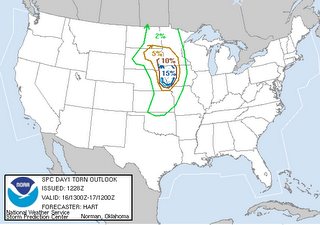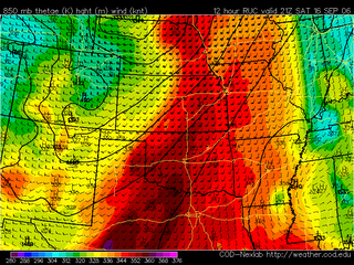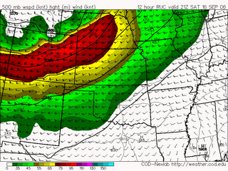

 This is what you like to see in the model runs and wording on the Day 1 for storm chasing. Everyone out there be safe!
...SD/MN/NEB/IA THIS AFTERNOON THROUGH TONIGHT... SATELLITE IMAGERY CONFIRMS THAT GENERALLY CLOUD-FREE SKIES WILL REMAIN IN PLACE OVER THIS AREA TODAY...LEADING TO TEMPERATURES WELL INTO THE 80S AND DEEP MIXING. THIS WILL HELP TO TRANSPORT RICH LOW LEVEL MOISTURE NORTHWARD AND DESTABILIZE AIRMASS /MLCAPE VALUES OF 1500-2500 J/KG/. SUBSIDENCE BEHIND OVERNIGHT SYSTEM WILL TEND TO SUPPRESS DEEP CONVECTION UNTIL EARLY AFTERNOON. THUNDERSTORMS ARE THEN LIKELY TO RAPIDLY DEVELOP FROM THE SURFACE LOW OVER SD INTO PARTS OF EASTERN NEB ALONG TRAILING DRYLINE. FORECAST SOUNDINGS IN THIS REGION SHOW EXTREMELY STRONG LOW AND DEEP LAYER VERTICAL SHEAR PROFILES FAVORABLE FOR SUPERCELLS AND TORNADOES /6KM SHEAR OF 50-70 KNOTS AND 3KM HELICITY OF 300-500 M2/S2/. INITIAL STORMS WILL HAVE THE POTENTIAL FOR VERY LARGE HAIL AND STRONG TORNADOES. ACTIVITY WILL LIKELY REMAIN SUPERCELLULAR AS IT TRACKS ACROSS WESTERN IA AND SOUTHWEST MN...BEFORE EVENTUALLY ORGANIZING INTO A SQUALL LINE AFTER DARK WITH AN ENHANCED THREAT OF DAMAGING WINDS.


No comments:
Post a Comment